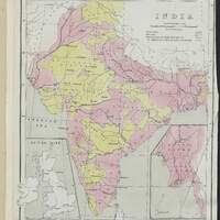
Statistical atlas of India
Classe
Image fixe
Type
fre
Atlas
Titre
eng
Statistical atlas of India
Titre alternatif
eng
Statistical atlas of India / Prepared for the Colonial and Indian Exhibition, 1886
Auteur
eng
Government of India
Contributeur
Éditeur
eng
Superintendent of Government Printing, India
Date
Couverture spatiale
Format
fre
PDF
fre
155 Mo
fre
82 vues
Technique et dimensions
fre
Atlas
fre
49 pages
fre
47*38 cm
Echelle géographique
1:8.110.080
En couleur ou Noir et blanc
fre
En couleur
Source
fre
Université Côte d'Azur. BU Lettres Arts Sciences Humaines. Fonds ASEMI
Cote
ASE 8269
Identique à
Droits
fre
Domaine public
Identifiant pérenne
Source(s) utilisée(s)
Description
Cet atlas statistique de l'Inde a été préparé en vue de l'exposition coloniale et indienne (Colonial and Indian Exhibition), qui s'est tenue en 1886 au Royaume-Uni dans le district de South Kensington, non loin de Londres. Son but, selon les mots du Prince de Galles de l'époque, était "de stimuler le commerce et de renforcer les liens d'union qui existent maintenant en tout point de l'empire de Sa Majesté". L'exposition a été inaugurée par la reine Victoria et, à sa fermeture, elle avait accueilli 5,5 millions de visiteurs.
La préface de l'atlas précise : "The "Statistical Atlas", less complete in details and range of subject than Mr. Cotton's compilation, is intended only to give a general idea, to a great extent through the agency of maps, of the character of the country, its inhabitants and agriculture, with the addition of such statistics as may serve to illustrate its commercial and educational progress. The small scale on which the maps are drawn compels the elimination of many of the details which are to be found on the large Exhibition charts ; but inasmuch as the object in view is only to exhibit the characteristics of India in broad lights and shades, the absence of detail will perhaps be no disadvantage.".
Collections
Ressources liées
Filtrer par propriété
| Titre | Libellé alternatif | Classe |
|---|---|---|
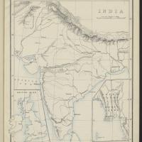 Physical configuration Physical configuration |
Image fixe | |
 Geology Geology |
Image fixe | |
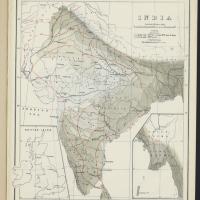 Average rainfall and temperature during the hot weather period - March to may inclusive Average rainfall and temperature during the hot weather period - March to may inclusive |
Image fixe | |
 Average rainfall and temperature during the rainy season or south-west monsoon period - June to october inclusive Average rainfall and temperature during the rainy season or south-west monsoon period - June to october inclusive |
Image fixe | |
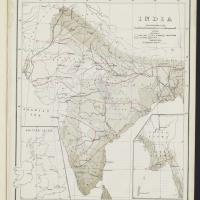 Average rainfall and temperature during the cold weather or north-east monsoon period - November to february inclusive Average rainfall and temperature during the cold weather or north-east monsoon period - November to february inclusive |
Image fixe | |
 Emigration Emigration |
Image fixe | |
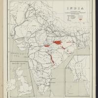 Railways, coal and iron Railways, coal and iron |
Image fixe | |
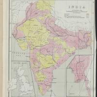 British provinces & Native states British provinces & Native states |
Image fixe |

